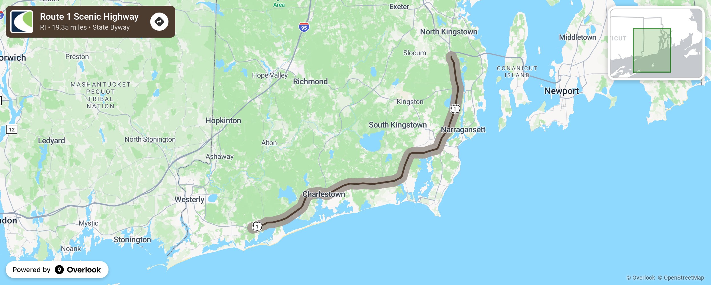
Route 1 Scenic Highway

Charleston’s Route 1, also known as Post Road, travels across Southern Rhode Island and contains many well-preserved natural resources. On the north side is the edge of the glacial Charlestown Moraine with thick and striking foliage from a variety of species of trees. The very wide median has attractive plantings to block the view of oncoming traffic in many of areas. On the south side, the vegetation is lower and offers glimpses of the South County’s salt ponds. Historical sites include the 1667 Stanton Inn, the Wilcox Tavern, the Joseph Stanton House and monument, and a red saltbox. Exit signs lead the traveler to these and other historic sites, many on the National Register of Historic Places. Stretches of undeveloped coastline and large salt ponds that connect to the Atlantic Ocean through breachways offer numerous recreational opportunities. Burlingame Park, Rhode Island’s largest campground is also along this byway. Route 1 in the South Kingston area began as a web of Native American trails used for centuries. Then the colonists developed the road as an important route to carry mail and newspapers. Today, the route has a smattering of residential and commercial areas in the north section and open spaces, ag land, marinas, and forested areas south of the Wakefield cut-off. Vegetation along the route includes deciduous, coniferous, and mixed forests. Point Judith Pond, Silver Spring Cove, Mill Pond, Perch Cove and sometimes Indian Lake can be seen from the road. On a clear day, Aquidneck Island and the city of Newport can be seen across the Narragansett Bay. Stone walls bound 4 miles of early farms and settlements. Historic places to stop are Willow Dell, Whaley Farm, Rocky Meadows Farm, Jeremiah Robinson House, Shadblow Farm, the Robert Beverly Hale Library, the Helme-Torrey Cemetery, and the Observation Tower and Hannah Robinson Rock. About a ½ mile of the route passes through the town of Narragansett adding the traveler opportunities to walk the seawall, enjoy the beaches, and savor the architecture and fresh seafood in this harbor town. More from National Scenic Byway Foundation →
Embed this map on your site
You are welcome to add this map to your own website for free, as long as you do so using the below code snippet in its entirety.
Please get in touch with us if you have any questions!
      <iframe src="https://overlookmaps.com/byways/ri-route-1-scenic-highway"></iframe>
    <a href="https://overlookmaps.com/">Map courtesy of Overlook Maps</a>