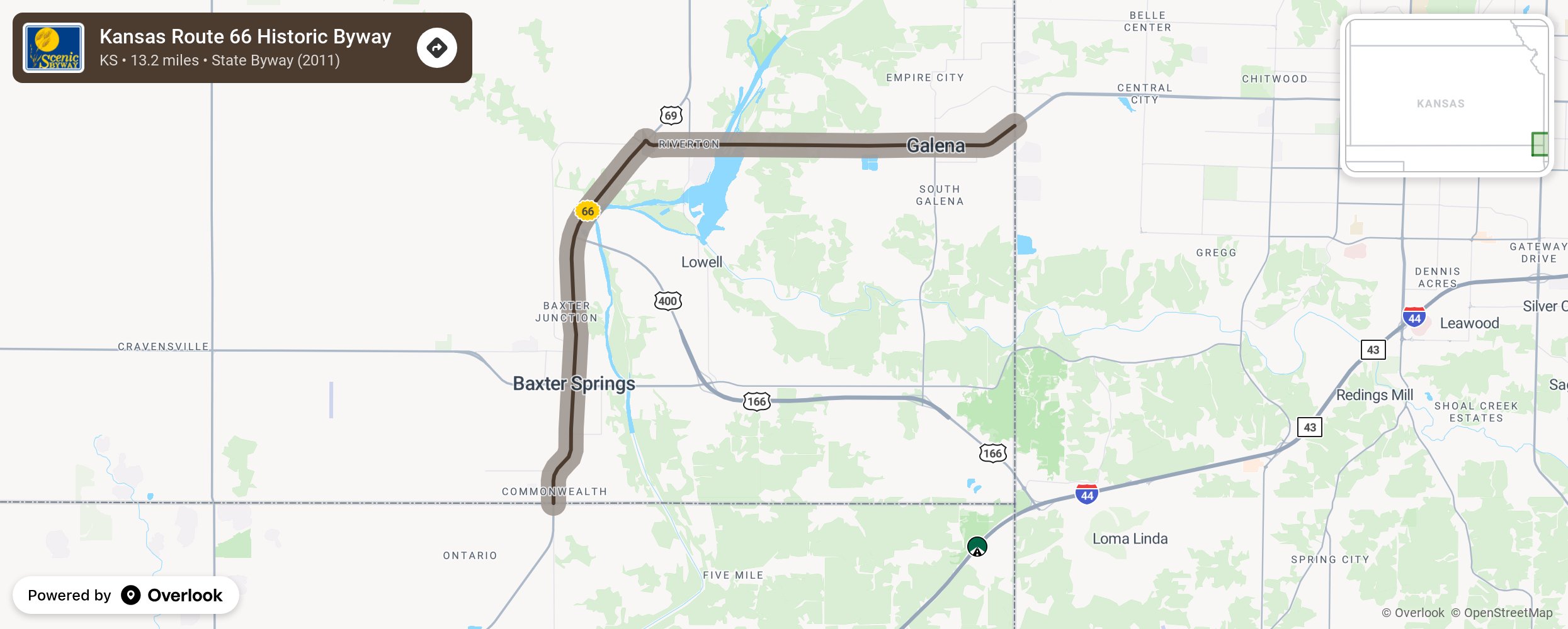
Kansas Route 66 Historic Byway

The southeast corner of Kansas sits on the Springfield Plateau of the Ozarks and plays host to 13.2 miles of America's Mother Road "Route 66." Route 66 travels from Illinois to California and offers a variety of experiences. Starting at the Missouri state line coming into Galena, travelers will see a recovering landscape from the lead and zinc mining era, a "KATY" railroad viaduct, and a Kan-O-Tex gas station which is home to the tow truck that inspired "Mater" in the movie "Cars". Downtown at "Pappy Litch Park," enjoy murals and the "ghost advertising" from the town's heyday. Heading west, stop at the Galena Mining Museum before making the short trip to Riverton, which plays host to "Nelson's Old Riverton Store," a 75-plus year old continuously operating general store. Proceeding west, highlights include the tallest tire "rim" sculpture on Route 66 and the Marsh Arch "Rainbow" Bridge, the last bridge of this design on Route 66 and one of 11 places in the Kansas Route 66 corridor on the State or National Register of Historic Places. In Baxter Springs, check out Sunflower Park, Ft. Blair Historic Site, Baxter Springs Heritage Center & Museum, the Kansas Route 66 Visitors Center, murals, an award-winning veterans memorial, and National Cemetery Plot #2 dedicated to the Union soldiers who died during the Battle of Baxter Springs in October, 1863. Before leaving Kansas for Oklahoma, visit the Southeast Kansas Nature Center at Schermerhorn Park (a beautiful 1930's Works Project Administration construction) and the Tri-State Marker. More from National Scenic Byway Foundation →
Embed this map on your site
You are welcome to add this map to your own website for free, as long as you do so using the below code snippet in its entirety.
Please get in touch with us if you have any questions!
      <iframe src="https://overlookmaps.com/byways/ks-kansas-historic-route-66-byway"></iframe>
    <a href="https://overlookmaps.com/">Map courtesy of Overlook Maps</a>