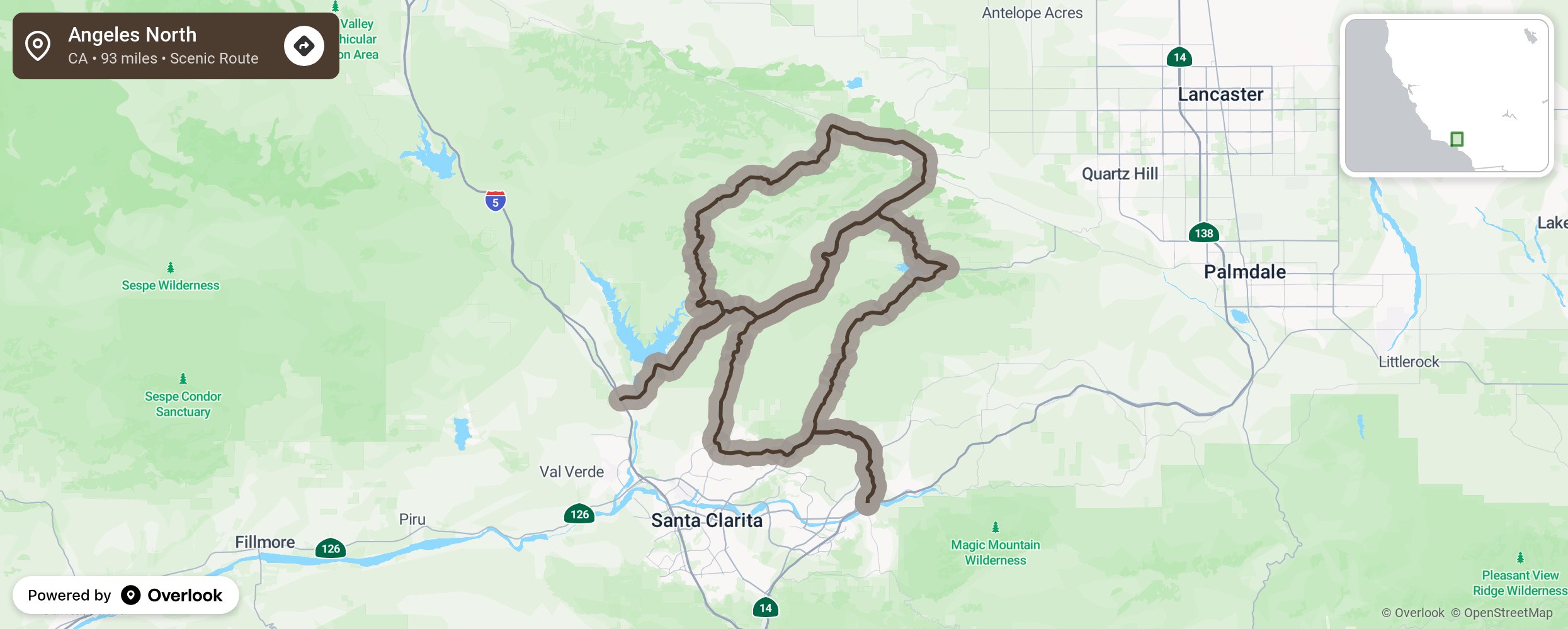
This pair of connected loops totals 93 miles and is accessible from either I-5 or CA-14, north of Santa Clarita. Castaic Lake State Recreation Area is nearby. Note that the included 2 mile stretch called Dry Gulch Road is narrow, unpaved, and has two-way traffic.
Embed this map on your site
You are welcome to add this map to your own website for free, as long as you do so using the below code snippet in its entirety.