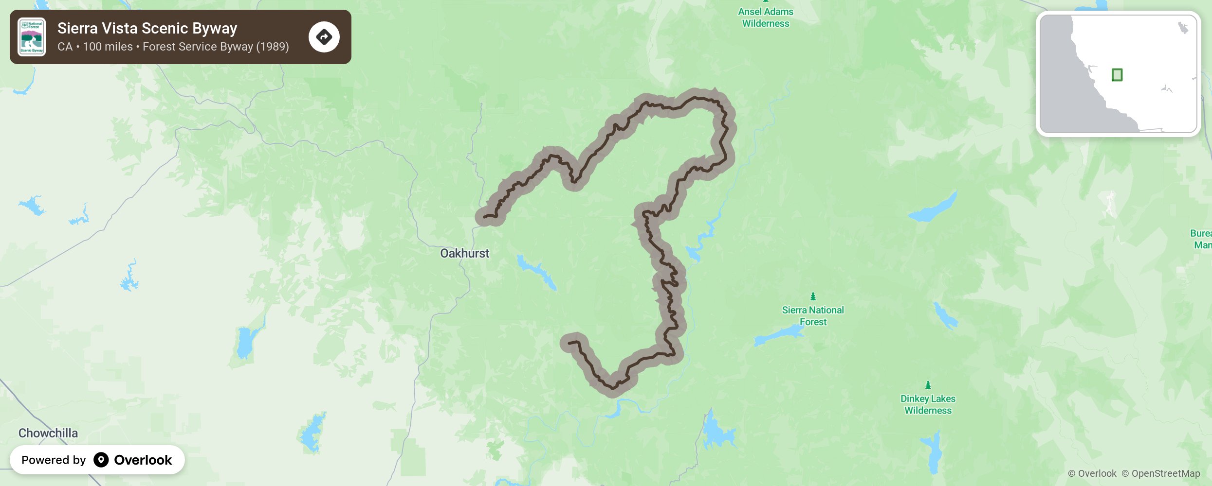
Sierra Vista Scenic Byway

The Sierra Vista Scenic Byway (SVSB) is a loop of 100 miles into the heart of the Sierra Nevada. It provides access to trails, lakes, historical and cultural sites, camp grounds, a Giant Sequoia grove, unique rock formations, and multiple activites, including fishing, horseback riding and some of the best backpacking in the Sierra. One end is North Fork, California and the other is Oakhurst, California. It is also possible to access the Byway from Bass Lake. The Byway is known for its incredible views from the San Joaquin River Canyon to the Crest of the Sierra Nevada. Most of the road is paved. There are opportunites to take short cuts and side trips. Lodging, stables, and a historic hamburger and pie store are available in the late spring to early fall. Be sure to check with the Bass Lake Ranger Station or Oakhurst Visitors Center about road conditions before beginning your journey. Due to recent heavy snow storms, the road is subject to repair. The SVSB was designated as a National Forest Scenic Byway in 1993 with the purpose of attracting tourism to compensate for economic losses due to the stoppage of timber harvesting. Since then it has experienced fire, floods and winds that have opened up the magnificent views. Brief descriptions of the stops along the Byway: Redinger Overlook From this roadside stop is a view of Redinger Lake, a reservoir that is part of the Southern California Edison hydroelectric project. There are also views of table top mountains that were once river beds. Jesse Ross Cabin The oldest standing structure in Madera County. Built in the 1870s by a homesteader it was surrounded by an apple orchard. Many of the trees remain, as well as others subsequently planted, and still used commercially. It is open to the public with no restrictions. Mile High Vista For many the highlight of the Byway experience. It offers 360 degree views into the heart of the Sierra Nevada range, including 2 National Parks and 3 National Forests. Thirteen thousand foot plus peaks, including a volcano are visible as well as Mammoth Pool reservoir, several meadows, unique rock formations. A great place for a picnic. Arch Rock After walking down a short, wheel chair accessible path visitors will come upon Arch Rock. A relatively small, but fascinating natural structure, viewable from a platform built by Boy Scouts and maintained by the Forest Service and the Scenic Byway Association volunteers. Jackass Meadow. A 1/4 mile walk on a path and platform leads into Jackass Meadow, a typical Sierra string meadow that is surrounded by Lodgepole pines. During the spring and early summer the meadow is often covered with wildflowers. Later in the summer, cattle may be grazing in the meadow. Globe Rock One of the more unique formations in the Sierra Nevada., a 20 foot diameter globe like rock on what appears to be a pedestal. The process of formation will surprise most visitors. Cold Springs Meadow A short walk down a wheel chair accessible path, leads to another beautiful meadow, with a magnificent view of Madera Peak. Again, in the spring and early summer a myriad of varieties of wild flowers cover it. Down the road is historic Jones Store, home of burgers and unbelievable pie ala mode. Nelder Grove An incredibly accessable Giant Sequoia grove that not only wanders through many huge redwood trees, but offers solitude unknown in most sequoia groves. Good, well marked trails, dogwoods, creeks, and other conifers make this a special place. It is close to one end of the byway about 20 minutes off of Highway 41, which leads to Yosemite National Park. Sierra Mono Museum While not officially part of the Byway, it is located in North Fork at one end of the SVSB. It is a fantastic place to view artifacts and earn the history of the local Aim or Mono people. Itinerary If you want to drive the entire 100 miles Byway, we encourage you to make it a full day adventure, allowing for time to linger and enjoy the short hikes, and read the informative signs. However, alternative, shorter routes are possible. Plan to at least visit Mile High Vista, and Nelder Grove, if possible. A map, brochure, and free audio tour are available on the website. More from National Scenic Byway Foundation →
Embed this map on your site
You are welcome to add this map to your own website for free, as long as you do so using the below code snippet in its entirety.
Please get in touch with us if you have any questions!
      <iframe src="https://overlookmaps.com/byways/ca-sierra-vista-scenic-byway"></iframe>
    <a href="https://overlookmaps.com/">Map courtesy of Overlook Maps</a>