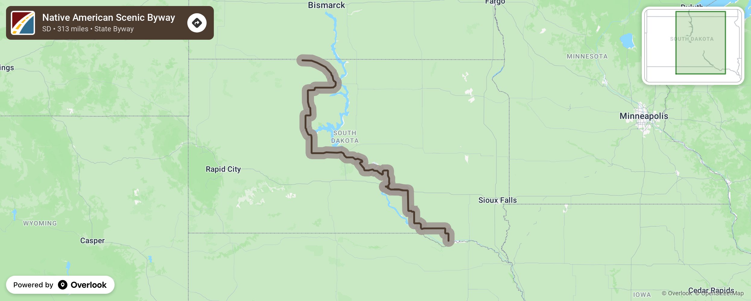
This Native American National and State Scenic Byway runs north and south through central South Dakota and through the lands of the Yankton, Crow Creek, Lower Brule, Cheyenne River, and Standing Rock Sioux Tribes. Views of the Missouri River and its diverse landscape frame the tribal history and culture of the area.
More from National Scenic Byway Foundation →
Embed this map on your site
You are welcome to add this map to your own website for free, as long as you do so using the below code snippet in its entirety.