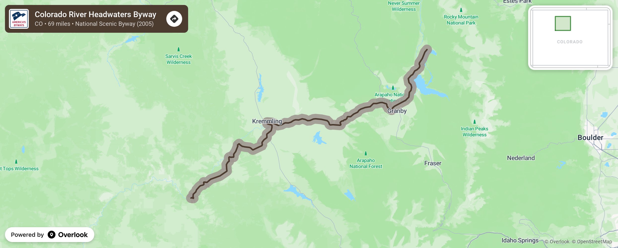
Dropping 1,700 feet in elevation from end to end, the Colorado River Headwaters Byway follows the Colorado past reservoirs and lush ranchlands, and through narrow canyons flanked by the railroad. Wildlife abounds and access to miles of public land offers year-round recreation and views of mountain landscapes and geology.
More from National Scenic Byway Foundation →
Embed this map on your site
You are welcome to add this map to your own website for free, as long as you do so using the below code snippet in its entirety.